Content

Showing posts with label Landscape. Show all posts

Avillion Admiral Cove @ Port Dickson

Tuesday, May 22, 2012 0 comments
Avillion Admiral Marina with the blue blue skies

Flower Lamp on a sunny day

Sunset moment marks the end of the day...

Lamp Post Sunset

Cresent Above Lamp Post....
Read more »

Manly Island, Sydney

Wednesday, December 28, 2011 0 comments

Manly is a suburb of northern Sydney, in the state of New South Wales, Australia. Manly is located 17 kilometres north-east of the Sydney central business district and is the administrative centre of the local government area of Manly Council, in the Northern Beaches region. 


For 150 years Manly Wharf has been the gateway to Manly. The first Manly Wharf was a fifty foot pier built on the present site, and it has been in continuous use as a ferry wharf ever since. Every year over 6 million commuters travel across Sydney Harbour on the scenic ferry or jet cat, passing through Manly Wharf on their way to and from work.


Buildings at Manly, NSW facing the sea


The road heading towards Manly Wharf

Manly Beach is a beach situated in Sydney's Northern Beaches, Australia. From north to south, the three main sections are Queenscliff, North Steyne, and South Steyne. Within walking distance of Manly Beach along the oceanway is Fairy Bower and Shelley Beach. There are shops, restaurants, night clubs, and dive bars in town. The beach was named by Capt. Arthur Phillip for the indigenous people living there. He wrote about them, "Their confidence and manly behaviour made me give the name of Manly Cove to this place". 


Write up: Courtesy of Wikipedia
Photo by Sidney Toh
Read more »

Sunset on Christmas Day 2011

Sunday, December 25, 2011 0 comments

Amazing sunset on Christmas Day 2011 captured from Kelana D'Putera Condo


The sun slowly setting down and prepare for the night


There gone the sun...Christmas will end soon

Photo by Sidney Toh

Read more »

Sydney Vicinity

Friday, December 23, 2011 7 comments


The Sydney Opera House is a multi-venue performing arts centre in the Australian city of Sydney. It was conceived and largely built by Danish architect Jørn Utzon, finally opening in 1973 after a long gestation starting with his competition-winning design in 1957. The Sydney Opera House is situated on Bennelong Point in Sydney Harbour, close to the Sydney Harbour Bridge. It sits at the northeastern tip of the Sydney central business district (the CBD), surrounded on three sides by the harbour (Sydney Cove and Farm Cove) and neighboured by the Royal Botanic Gardens.


Circular Quay is a location in Sydney, New South Wales, Australia. It is located on the northern edge of the Sydney central business district on Sydney Cove, between Bennelong Point and The Rocks. It is part of the local government area of the City of Sydney.


The Sydney Harbour Bridge is a steel through arch bridge across Sydney Harbour that carries rail, vehicular, bicycle and pedestrian traffic between the Sydney central business district (CBD) and the North Shore. The dramatic view of the bridge, the harbour, and the nearby Sydney Opera House is an iconic image of both Sydney and Australia. The bridge is nicknamed "The Coathanger" because of its arch-based design.


Write up: Courtesy of Wikipedia
Photo by Sidney Toh
Read more »

Sydney's Observatory Hill Park

Thursday, December 22, 2011 2 comments

Observatory Hill Park is a popular attraction for locals, workers and tourists boasting one of the City’s best terrestrial vantage points for unobstructed panoramic views of Sydney Harbour and the Harbour Bridge. The Agar Steps provide pedestrian access from Kent Street and a cutting through the Harbour Bridge pylons provides pedestrian and cycle access from Cumberland Street. Public toilets are located nearby on Watson Road at the foot of the Lower Fort Street park entrance. The park is well serviced by bus routes however no parking is available within Observatory Hill Park. The park contains numerous works of public art and a wooden rotunda flanked by magnificent mature Port Jackson Figs. The rotunda is the City’s most popular outdoor venue for weddings and naming ceremonies; bookings are required for exclusive use of the rotunda. The park is an off-leash area at all times and is highly popular location for walkers, joggers and fitness enthusiasts. The park’s shaded benches located around the orbital pathway are a popular destination for the less sports inclined visitor. The heritage listed Sydney Observatory, built in 1858 is located at the apex of the park. The Observatory, Australia’s first, containing numerous historic and modern telescopes, scientific artefacts and a beanbag planetarium, is open to the public throughout the year.


Write up: Courtesy of City of Sydney
Photo by Sidney Toh
Read more »

Sunset from Kelana D'Putera Condo

Tuesday, December 20, 2011 0 comments

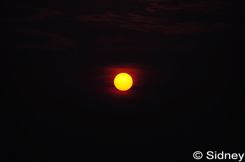
Photos captured about 130 feet above the ground during hot weather back in the month of September 2011. The sun was so round and orange the skies....


Filtered with CIR-PL and tinted glass to come out with this effect


Flying eagle is enjoying the scenery which keeps on flying around the sun

Photo by Sidney Toh
Read more »

Putrajaya Vicinity

Saturday, December 17, 2011 8 comments

The Seri Wawasan Bridge is one of the main bridges in Putrajaya, the Malaysian federal administrative capital. This futuristic cable-stayed bridge which has a sail ship appearance, connects Precinct 2 on the Core Island to the residential area of Precinct 8. The concrete bridge is a combination of cable backstays and structural steel tie back. It is a dual three lane carriageways of 18.6m width each, comprising 3 x 3.5m width lanes, 0.5 m hard shoulder, 0.5m marginal strip. The median is 4 m wide and walkway cum cycle track width is 5.1m giving a total width of 37.2m at the centre of the bridge.


Angle captured from bottom of the bridge to create an abstract feel of a wing


The Perdana Putra is a building in Putrajaya, Malaysia which houses the office complex of the Prime Minister of Malaysia. Located on the main hill in Putrajaya, it has become synonymous with the executive branch of the Malaysian federal government.


The Putra Mosque, or Masjid Putra in Malay language, is the principal mosque of Putrajaya, Malaysia. Construction of the mosque began in 1997 and was completed two years later. It is located next to Perdana Putra which houses the Malaysian Prime Minister's office and man-made Putrajaya Lake. In front of the mosque is a large square with flagpoles flying Malaysian states' flags.

Write up: Courtesy of Wikipedia
Photo by Sidney Toh
Read more »

Taiping Lake Garden

Tuesday, December 13, 2011 2 comments

Taiping (太平) is a town located in northern Perak, Malaysia. With a population of 191,104 (in 2007),[1] it is the second largest town in Perak after Ipoh, the state capital. Taiping took over Kuala Kangsar's role as the state capital from 1876 to 1937, but was then replaced by Ipoh.[2] Its development slowed down after that, but in recent years the town has begun developing rapidly again. Taiping also receives some limelight for being the wettest town in Peninsular Malaysia. The average annual rainfall is about 4,000mm in Taiping while the peninsula's average is 2,000mm – 2,500mm. Its unusual rainfall has also led to a fertile collection of flora and century-old rain trees in the Taiping Lake Gardens.


Photos captured in the morning about 9:30am and luckily it was a bright day...As you know, Taiping is the wettest town in Peninsular Malaysia.


Write up: Courtesy of Wikipedia
Photo by Sidney Toh
Read more »

Enthusiast

Popular Posts